FGIS_online - Forest Web GIS


Assignments
The task was to develop the web-based geographical forestry information system FGIS_online into a modern and efficient Web GIS platform. The aim was to support specific specialist tasks through the platform by creating appropriately focused apps. These apps would then be capable of applying existing Sachsenforst services and services from the SDI Saxony in a variety of specialist application cases.
The flexibility of the new web GIS platform FGIS_online has already sustainably proven itself. Both the liming app and the web GIS app have been implemented and put into operation quickly and efficiently.
Beate Graichen - Staatsbetrieb Sachsenforst
Customer
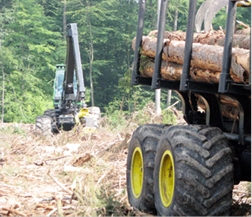
Sachsenforst (the Saxony state forestry service) is the agency responsible for forests in the state of Saxony. Distributed throughout the state, its 1,600 employees in the forest regions manage the Saxony state forest and provide advice and support for private and corporate forest owners. Sachsenforst is responsible for around 200,000 ha of state forest land and also looks after approximately 50,000 ha of forest under local government and corporate ownership.
As the upper forestry and hunting authority, the state forestry service is also responsible for land-use management in the major conservation areas in Saxony. These are:

Saxon Switzerland national park region,
Upper Lausitz Heath and Pond Landscape biosphere reserve,
Königsbrück Heath conservation areas,
Gohrisch Heath and Zeithain Lower Elbe Terrace.
In these regions, Sachsenforst is the specialist conservation agency responsible for large conservation areas.
Solution
The new web GIS platform FGIS_online was implemented on the basis of con terra's map.apps technology. The apps created on the platform offer not only standard functions such as spatial data visualisation, map printout and data searching but also extended functions within the SDI Saxony, such as:
Linking to the central user manager (ADS)
Realisation of a central map catalogue
Provision of hierarchically structured name directories
Realisation of a land area directory linked to the central attribute information system
Collecting and editing relevant spatial information
Flexible and central configuration of information and recording layers
The solution is based on
map.apps
map.apps SDI
security.manager
Benefits
The web GIS platform FGIS_online operated by the Sachsenforst state forestry service enables the efficient implementation of specialist apps for supporting employees in forestry and hunting areas, people involved in state forestry service management, as well as ministry employees, in performing their forestry-related activities, work procedures, and decision-making processes.
The first apps have already been developed on the new platform: a general web GIS app has been successfully deployed as the successor to the previous system. Moreover, the introduction of a new liming planning app has already resulted in a significant reduction in workloads.
The Sachsenforst state forestry service has created a future-proof solution in the form of the web GIS platform FGIS_online, which enables it to employ modern approaches to app creation and service orientation for its own purposes.
Functions
Searching for and visualising data with relevance to forestry
Provision and printouts of maps
Rapid location of spatial forestry objects with the aid of name directories
Integrated user management
State-wide recording of specialist forestry-related themes
Querying of inventory information from the operational database
Addition of further map services
Summary
The web GIS platform FGIS_online is designed to enable the efficient creation of appropriately focused apps for supporting the tasks of the Sachsenforst state forestry service. Thanks to the underlying map.apps technology, it offers a maximum degree of future orientation. The first apps have already resulted in a significant decrease in workload.

Martin Stöcker